The area is access sensitive
🔴 A moderate clearance, AWD or better vehicle is recommended. A lower clearance vehicle can park about 100 yards uphill of the river access. 🔴 The parking for this area is used by rafting companies fo... Read more
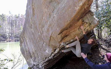
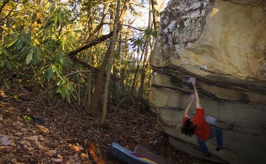
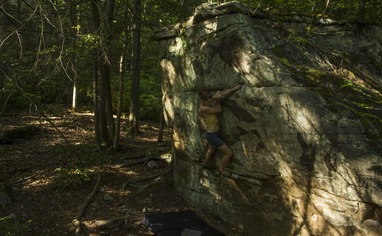
We like Canyon Doors Boulders

Activities on this crag
Nearby crags
The area is access sensitive!
🔴 A moderate clearance, AWD or better vehicle is recommended. A lower clearance vehicle can park about 100 yards uphill of the river access.
🔴 The parking for this area is used by rafting companies for river access during Gauley season. Please do NOT go to this boulder on release days during Gauley season: this includes Friday through Monday starting the 2nd week of September through October. Gauley release schedule can be found here: https://www.lrh-wc.usace.army.mil/wm/?wwsched
🔴 This area is water level dependent. There is not a good landing spot for a raft (or similar) once the water is above about 3000 cfs. Check the water level here: https://www.americanwhitewater.org/content/River/view/river-detail/2379/main
🚗 Driving directions:
From Fayetteville:
Follow US-19N. Take the exit on US-60/Midland Trail exit. Turn RIGHT off the exit and drive 1.1 miles then turn RIGHT onto Stringtown Rd. Drive 0.1 miles then turn LEFT onto Hawver Rd. Take Hawver Rd 2.6 miles then take the SECOND (2nd) RIGHT onto Saturday Rd. Drive 2.5 miles on Saturday road then turn LEFT onto Lucas Rd. After 1.0 miles Lucas stay RIGHT to continue on Lucas road as it turns into gravel. Drive 4.6 miles on gravel road, stay straight/left at the final intersection and drive a short ways down the hill to the river bank.
From Summersville:
Follow US-19S. Take the exit on US-60/Midland Trail exit. Turn RIGHT off the exit and drive 0.9 miles then turn RIGHT onto Stringtown Rd. Continue following the above directions.
🚶♂️Hiking Directions:
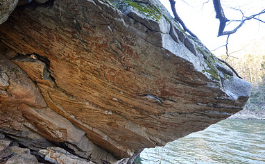
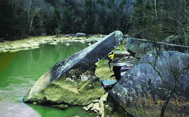
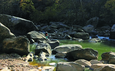
For the Skull Cave Boulder: This boulder is visible just upstream, across the river from the parking. Float across the river in a slightly upstream direction. The fastest current is about 1/3rd of the way off of river RIGHT (right side of the river when heading downstream, this is the far bank from the parking). Just past the fastest current is a good eddy to help prevent floating farther downstream. It is easiest to park your raft (or similar) just downstream of the boulder and scramble 50 feet over the riverside talus in an upstream direction.
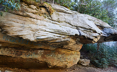
For the Really Big Roof: Head downstream with your raft (or similar) from the parking. Just before entering the small rapid at the downstream end of the pool, there is a small boulder sitting just off the river RIGHT (right side of the river when heading downstream, this is the far bank from the parking). Pull just behind this boulder and into its eddy, parking the boat just behind. Walk the cut trail into the rhododendrons and uphill until reaching a clearing for an old road. Head left down the road until you reach the Really Big Roof. YOU NEED A RAFT TO GET TO THESE BOULDERS. You need to be able to paddle through moving water (not whitewater). There's some slippery talus and some elevation gain. Total walking time is 2 to 3 minutes.