
Climbing has been limited
⛔️🦉 "Pfarrfels" is closed from 1.2 - 30.6. because of bird breeding. 🚗 These sectors are located around the village "Egloffstein" at the river Trubach. Go To "Egloffstein" and park at the big parking ... Read more
We like Egloffstein


Activities on this crag
Nearby crags


Climbing has been limited!
⛔️🦉
"Pfarrfels" is closed from 1.2 - 30.6. because of bird breeding.
🚗
These sectors are located around the village "Egloffstein" at the river Trubach.
Go To "Egloffstein" and park at the big parking in the center of town where the road crosses the river. 50 meters south of the bigger new parking is a smaller cozier parking...if you like.
🏃🏼
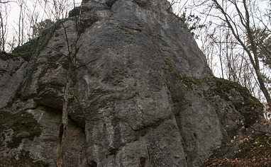
Pfarrfels/Balkenstein:
Go to the big parking in the bend and get onto the road called "Badstraße" (leading to swimming pool), directly across the big parking. After 200 meters take the road to your right what continuous into a hiking trail leading into the forest. You get onto a hiking trail immediately that leads along the hill side. Take the left direction. After about 450 meters you can spot the massive sector "Pfarrfels" to your right up the hill. There's an obvious path leading there. 300 meters further ahead on the hiking trail you pass "Balkenstein" underneath. Get there on no cleat path up the hill.
Holzhauswand:
this gets tricky.. Go to the big parking in the bend and get onto the road called "Dr. Neumeyer Straße"", directly across the big parking. Go up the steep street until the. Follow the street through the left bend for a few meters and look for a hiking trail (blue circle sign) disappearing into the bushes up the hill. Go up the hiking trail for 130 meters until it bends left. Take the forest road to your right leading along the hill side. After a few meters take the left path and follow it for further about 80 meters until you've reached the top. When the path already goes down the hill leave the path to the right just after you've past the thicket. There's another path starting about 40 meters parallel left of the path you are leaving. Once you've reached that path you just have to follow it for 160 meter. The sector is to your left.
Alternatively you can follow the street "Dr. Neumeyer Straße" to the end, then turn left before you get onto the Main street. You get onto a hiking trail soon. After 250 meters where you enter the forest is a forest road to your left. This one gets you to the sector within 200 meters.
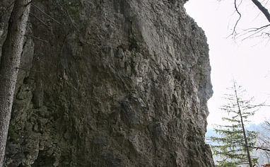
Alfred Dürer Fels:
Follow the street towards town center and get onto the street (Paradiesweg) leading up the hill just after you've crossed the river. Turn left after 90 meters and follow the street until it turns into a hiking trail leading into the forest. After about 100 meters turn right onto the hiking trail leading up the hill via serpentines. In the 2nd right bend leave the trail to the left. You already can see the sector in front of you.