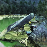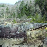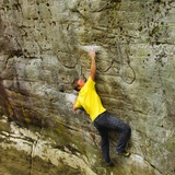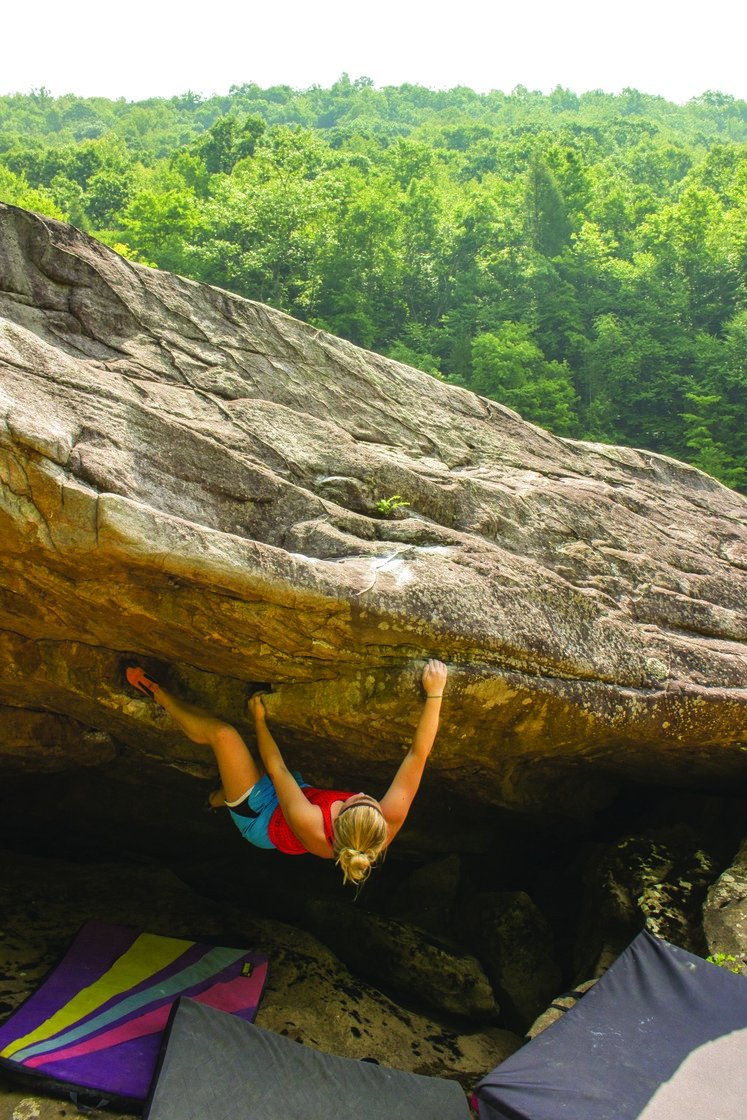

Summersville Dam is a scenic stretch of riverside boulders with easy access and a free campground. There are some fantastic standout classics here and many fun problems in between. "Pizza Slice" V8 is one of the best of its grade in the country. The trail is poor and/or rock hopping, and a bit of willingness to explore is helpful here, as the boulders are a bit scattered.
🔴 In the fall (and times of heavy rainfall upriver), the Army Corps of Engineers begins releasing water out of Summersville Dam, lowering the level of the lake. This happens Friday through Monday starting the second week of September until the end of November. Below the dam, of course, this means the Gauley River is raging. The release of the surplus of water from the dam creates one of the finest whitewater rivers on the east coast. Under the surface, world class boulders create the whitewater rapids. These boulders' time to shine is in the spring starting April 1st, when the dam is turned to minimum release of 7.5ft to refill the beautiful Summersville Lake. Similarly, during the end of Summer before the scheduled releases, low precipitation also will have the river at minimum flow. During this time the boulders along the Gauley's riverbanks are exposed and climbable. For all of the boulders in the river to be climbable, the water level should be about 7.5ft (400cfs); however there is still a lot of climbing when the water is up (i.e. Gauley Gee Boulders, Original Sin Boulder, and Hideaway Boulder). You can use this website to find the current river level: https://www.americanwhitewater.org/content/River/view/river-detail/2378/flow
🚶♂️ Approach summary - Variable. Chill to rugged. 2 to 20 minutes.
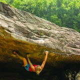
💎 Notable problems - "Tiger Lily" V2, "Zero Gravity" V2, "Vesper" V2, "Baloney Sandwich" V2, "Soap Drop" V3, "Pick Pocket" V3, "Vesper Low" V4, "Day Star" V4, "River Dog Right" V5, "Gauley Gee Wilikers!" V5, "Shut the Front Door" V6, "Encore" V7, "Pizza Slice" V8, "Black Sloper Problem" V8, "Hideaway" V9, "Forbidden Fruit" V10, "Rosewater" V10, "The Ark" V11, "Original Sin" V11
💧 Dry time - Hours to 1 day.
🍂❄️🍃 Seasonal Beta - Best in April while the dam is at minimal flow to fill up the lake. Otherwise Fall to Spring. Warm in the summer but the water is often low.
🌊 Water Level Beta - This is highly variable. Starting April 1st and until Summersville lake is full (usually 3 to 4 weeks), the water level on the Gauley is set to minimum flow of 7.5ft and all boulders should be climbable. In the fall, assuming low precipitation, Tuesday through Thursday on weeks of Gauley Release the water level is set at 8.5ft. The Gauley Gee Boulders, Hideaway, the right side of Original Sin Boulder, and several others are climbable regardless of the river level. Boulders that require minimum flow of 7.5ft include the Beauty Boulder, Sandshark Boulder, Black Sloper Boulder, and Swamp Ass Boulder. At 8.5ft and lower boulders climbable include Pick Pocket Boulder, Wastelands Boulder, Zero Gravity Boulder, Danger Zone Boulder, Rosewater, The Ark, and Encore. "Pizza Slice" is best at 9ft and lower.
🚗 Drive from downtown Fayetteville - 15 minutes
🚗 Drive from Summersville - 25 minutes
🚽 Bathrooms - Pit toilets at the parking area.
📶 Cell phone service - 3/5, variable.
🐶 Dogs - Must be leashed at all times. This is National Park and Army Corp land.