

Climbing has been limited
⛔️🧑🌾 The bolts at the back sector of "Treunitzer Pfeiler" ("Linker Einstieg" - "Promenadenweg") are chopped off. Obviously the landowner doesn't want the sector to be climbed. 🚗 The most sectors are... Read more
We like Wiesent- Paradiestal


Activities on this crag
Nearby crags


Climbing has been limited!
⛔️🧑🌾
The bolts at the back sector of "Treunitzer Pfeiler" ("Linker Einstieg" - "Promenadenweg") are chopped off. Obviously the landowner doesn't want the sector to be climbed.
🚗
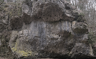
The most sectors are located in the Valley of "Paradiestal" which is a secondary valley of "Wiesenttal".
Best approach is via the motorway A70 from north. Approaching from south go all the Valley "Wiesenttal" up to "Hollfeld" and ahead the valley towards "Treunitz".
Parking is in a bend between "Treunitz" and "Steinfeld" where the street crosses the river.
🚶♂️
Torstein, Treunitzer Pfeiler & Treunitzer Wand:
Take the hiking trail south down the river stream. "Treunitzer Wand" is to your right immediately. Go ahead the hiking trail and you'll pass Treunitzer Pfeiler after 4 minutes and "Torstein" after 5 minutes.
All other sectors are located in the "Paradiestal" which you can enter as well from north. Access to "Wüstenstein" is quicker from north (check out the map) but for the sake of completeness access from south is mentioned here.
For all further sectors follow the street up north for 200 meters where a hiking trail is leading into the valley to your right. All further sectors are located in the valley-bottom next to that trail. Take the hiking trail, then further access information from the beginning of that trail: ->
Vorderer Paradiestalwächter:
this small sector is just next to the hiking trail after 300 meters.
Nasenlöcherturm:
After 520 meters on the right side. A small path is leading to the tower.
Dachstein:
after 850 meters right to the trail.
Gelbe Wand:
after 1.2 km to your right.
Paradieswand & Bambergerpfeiler:
after 1.35 km take the path up the hill to your right. follow that one for 80 meters to "Paradieswand". Go left along the hill side for 80 meters to "Bamberger Pfeiler"
Kulmbacher Wand:
after 1.75 km to your right across the lawn.
Zigeunerstube:
after 2.7 km to your right, just behind the crossroads.
Wüstenstein:
take the path from "Zigeunerstube" to your right following along the edge of the forest. after 100 meters take the foot path leading up the hill to the already visible crag.
Alternative approach from the hiking parking from north, that's just 1.4 km to "Wüstenstein".
Wüstenstein Nebenmassiv:
From where the path leading up the hill to "Wüstenstein". take the forest road to your left leading diagonal up the hill. Take that path for about 80 meters and leave it to the left. The sector is already visible from there.